All gear acquired, we packed it to the launch site on the big day. It was an hour and a half drive to Saskatchewan and felt windier then the forecast predicted. There were thoughts of postponing, for fear that the balloon would get away from us during the filling process, but given our very limited launch window, we went for it!
Filling proved to take a really long time. The low pressure balloon helium hissed into the balloon much more slowly than a proper high pressure cylinder would. We had plenty of hands to hold it safely in place so we pressed on.

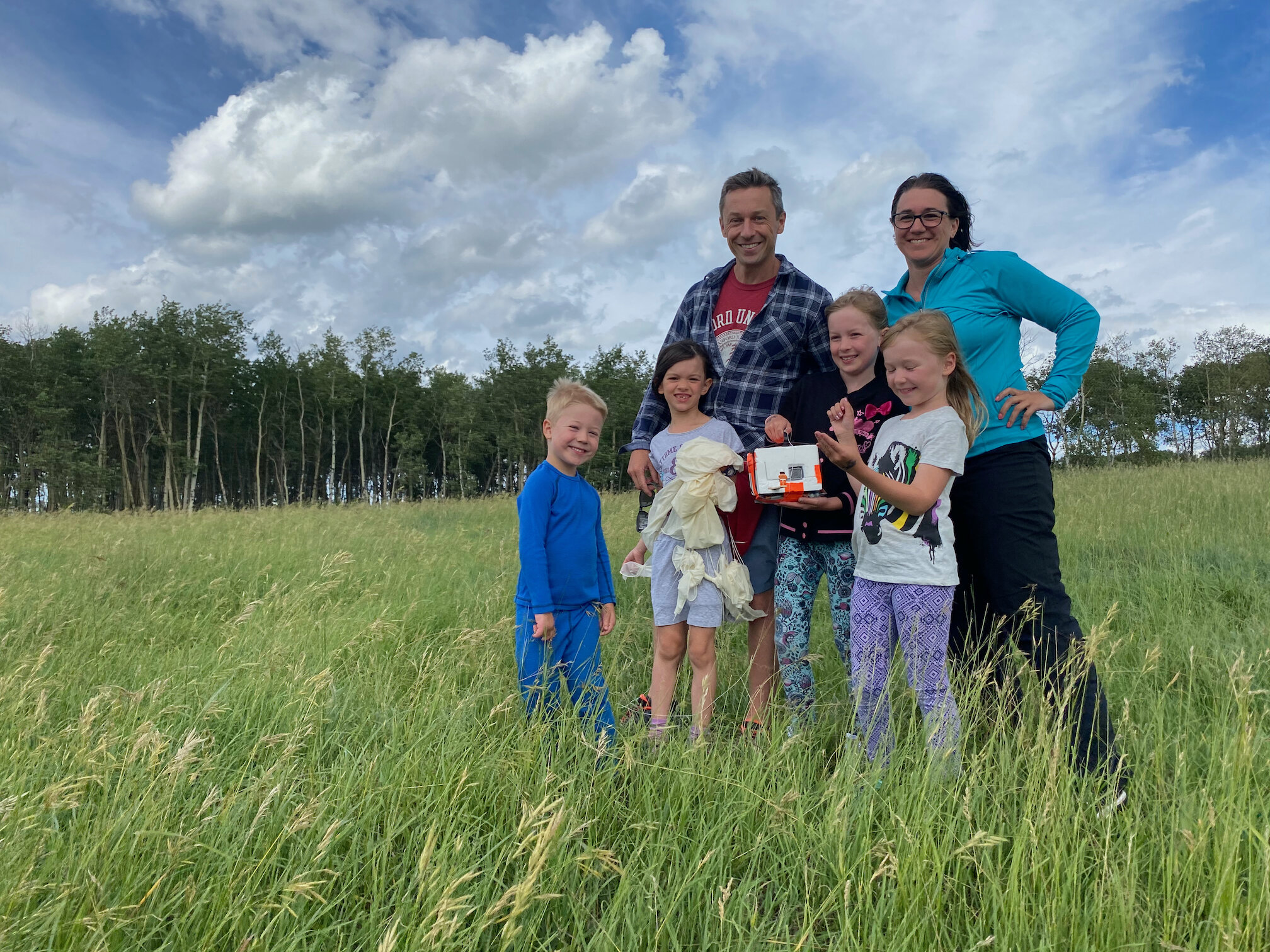
We simultaneously fired up the cameras and secured the bundle with zip ties and duct tape. We hooked up the long ‘train’ which connects the balloon to the parachute and payload, in that order. Drone in the air for a launch video. 5-4-3-2-1-Launch! WOW did it move! The wind and lift zipped it out of sight in about 20 seconds, but reassuringly in the right direction.

The crew celebrated with a stop at Tims for a treat and anxiously watching the SPOT app for location updates every 5 minutes.

Making our way home we caught up with the balloon near Hamiota and got home for lunch while watching the flight track live in mission control.

We ended having positive telemetry from the SPOT up to 77,000 ft, which is way higher than we expected. The balloon went dark 3 hrs into the flight which was worryingly late based on our prediction - we had serious concerns about a long drift taking it off course. It was another hour before we spotted it again on the GPS track.. on roughly the predicted track, but just 50 km east of where we’d anticipated. Phew! 50 km we can deal with, 200 km would have been a pain.

The team jumped in the truck a tore across the countryside chasing the parachute which was coming down at about 1000 ft/min. We arrived at the landing site about 50 minutes after the chute. Thanks to Google maps, we could determine while en-route that the site was in the middle of a large cow pasture, about 200 ft from the road. Fantastic! We found it in a minute and were overjoyed that everything was intact.
Taking the payload apart, we found that the Canon still camera had malfunctioned shortly before launch, but that we got great GoPro video of the whole flight, stopping only minutes before the burst, when the 64GB SD card had filled with 4 hrs of HD video. I had calculated a much shorter flight, but lesson learned for next time.. put in a much bigger memory card.
As we were in a telemetry blackout at the time of maximum altitude, it took a bit of math and a spreadsheet to determine the ascent rate and calculate the apex - approximately 96,429ft (29,399m) - which was completely amazing. We made it!

Thanks to everyone who donated and bought gear. Thanks to grand-maman et grand-papa for your support and letting us raid your garage for parts. Thanks to the Thompson Coutures for participating in the Edventure Space Academy and playing a huge role on launch day.
Science is just so awesome.
