
Having heard about long crossings and nightmare waits, we were pleasantly surprised to find a well-organized and air-conditioned building in which to conduct all of the key border crossing steps. In order to cross into Guatemala, three of us had to present negative rapid-antigen tests (10 yrs and up). We shared our vaccination records as well. Erik was well prepared with photocopies of everything which saved us a few steps (without the copies, we would have been asked to walk to a store to pay for copies to be made). The only time-consuming step was to pay for our vehicle importation fee which could only be conducted at an official Bank. This was a km-long walk for Erik, plus a wait at the bank, and then the return walk. All in, we were 90 min at the border. Next challenge (as always, so far) was to find cellphone SIM cards and buy a data plan. Thankfully, the companies in Guatemala will also provide coverage in other Central American countries. In the border town, there are a number of stores that sell minutes and top-ups but not always the SIM cards. We had a few false steps and then found a place that could help us. It was a lengthy process as well but we were connected, fed, and on our way to our hotel by 2:00.


We decided to stay right at the base of the Tikal Archeological Site in one of the hotels so that we’d be able to get started on our tour first thing in the morning. We had to pre-purchase our entry tickets at the national park’s gate on our way into the park. This was also where we found Henry, an English-speaking guide, who agreed to meet us the next morning and take us through the best spots. Along the road into the park there are a number of caution signs each with a different animal. The extended park is a reserve for wildlife and we ended up seeing most of the animals on the signs. We saw wild turkeys, coatis, and spider monkeys. We did not see jaguars or snakes. The park is well monitored and the driving speed limits are enforced. Our hotel was a welcome sight. It had been a long day and we were feeling pretty hot in the humid tropical air. We ate a wonderful dinner, met a fellow Canadian who was travelling through Central America on a touring motorcycle and headed to bed early.


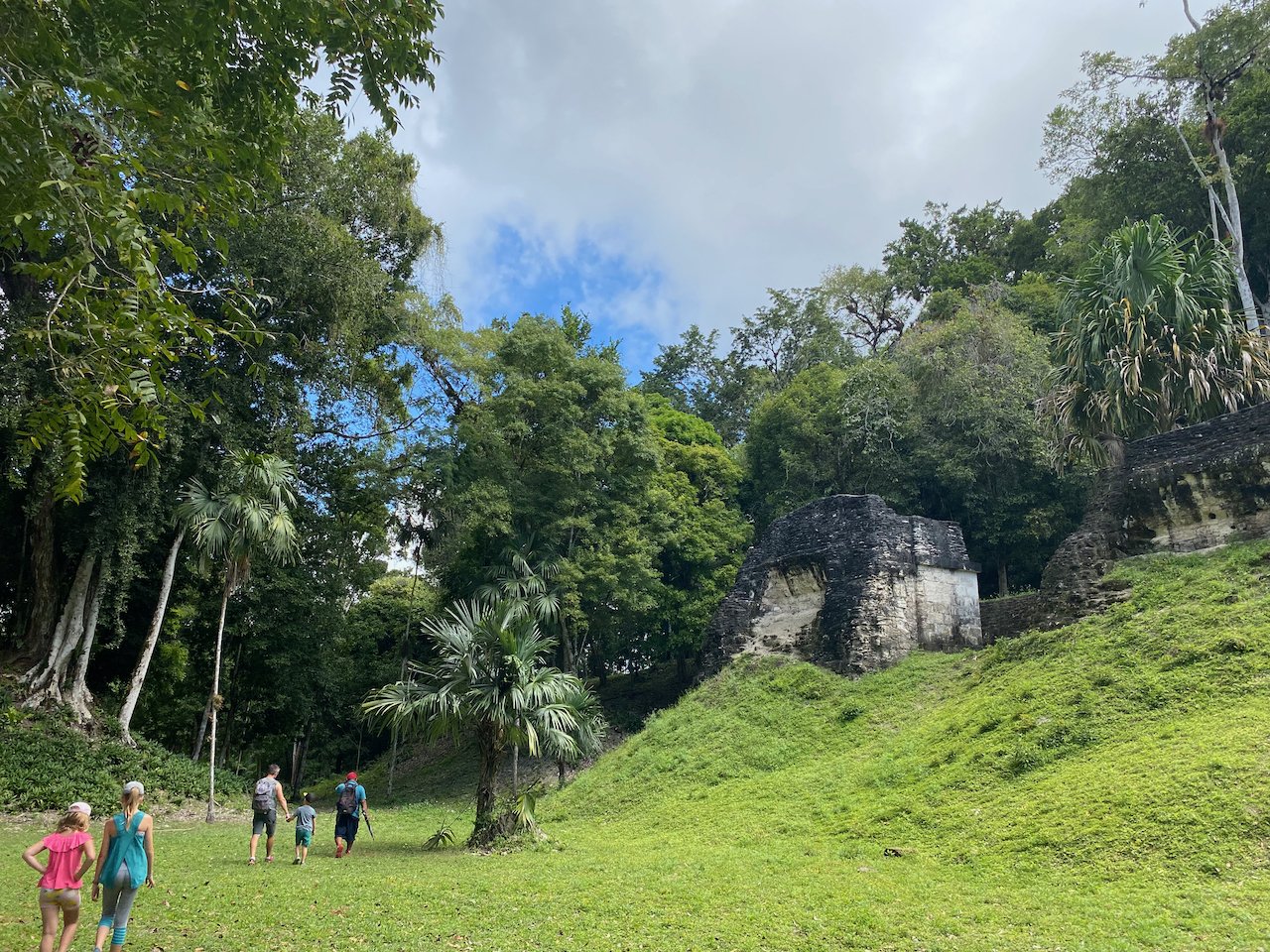
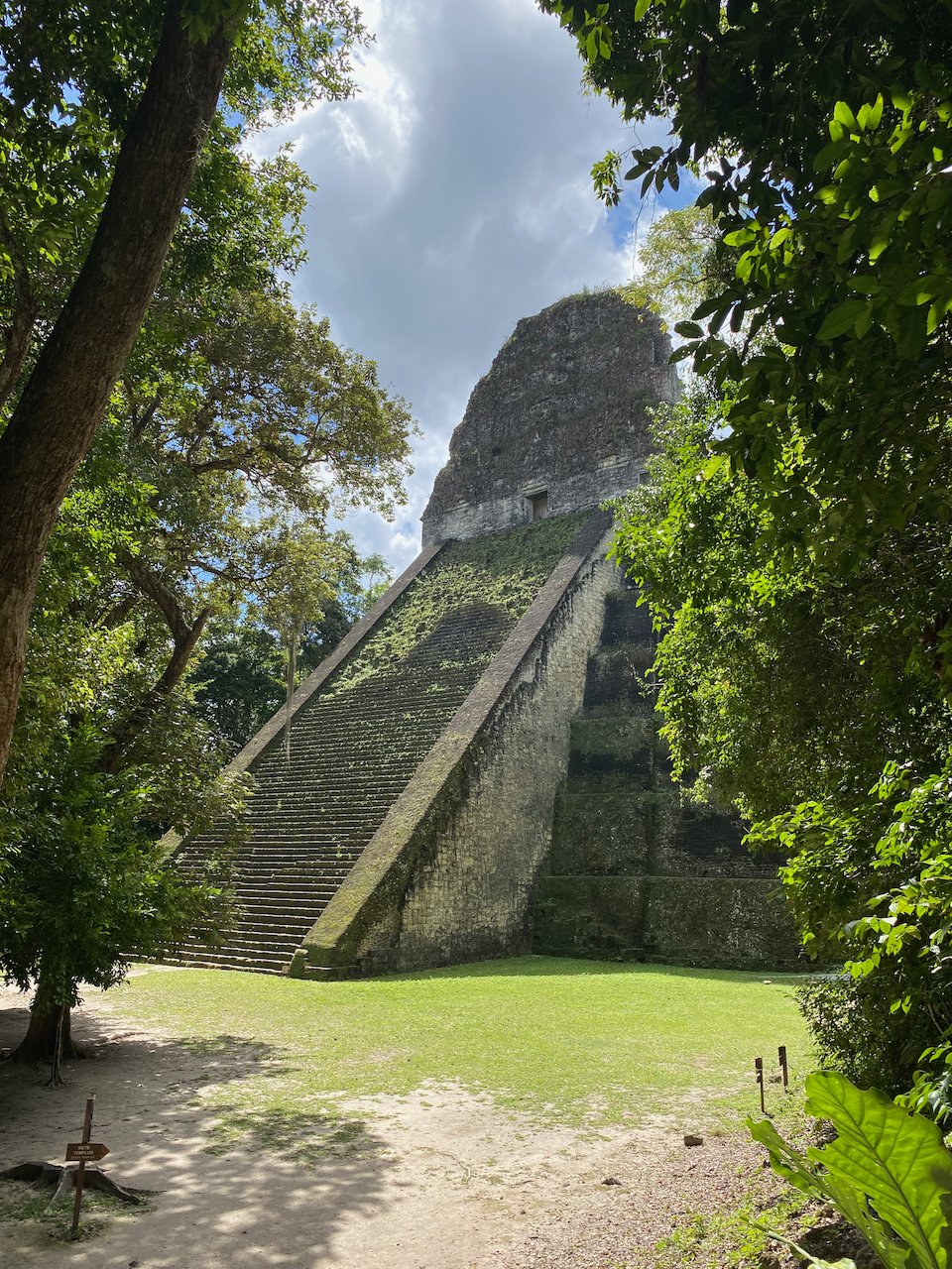
After a yummy breakfast, we met Henry and started our tour of the largest Mayan archeological site. In fact, Tikal is said to have been the capital city of the Mayan Civilization. It was quite large. We started with some of the smaller temples and ruins, learning about the archeological discoveries as well as the likely uses for each building. We could see pyramid-shaped mounds of ground covered in jungle right beside an excavated temple. We then went to some of the tallest spots, climbing over 100 steps to reach the top. The views were spectacular. You can see jungle canopy as far as the ground stretches with the tops of 3 or 4 other tall ruins. One of the sites was used in Star Wars as the planet housing the Rebel base. Henry also showed us the ball fields and offering temples that were unique to Tikal. We had seen one field in Chichén Itzá near Cancun, but these fields were smaller and there were three side-by-side. Henry shared with us what the current beliefs are as to why these fields were different and also shared that archeologists have found enough human remains to believe that the Captains of both the winning and losing teams were sacrificed at the end of the game. Ouch.


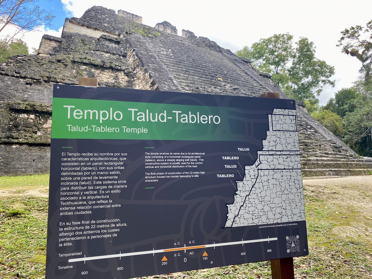


The main square of the city is very impressive. Henry saved this spot for last. Two large temples faced each other with palace grounds to one side and a large market area to the other. I have no doubt that it was a beautiful and impressive city. It was abandoned around 800-900 AD and the most popular supposition suggests that the city ran out of natural resources. Surprisingly, this location did not have a natural water source. It was chosen due to its large deposits of limestone for building, but no natural water source existed. There is evidence of water holding holes and possibly wells, but it’s a very long walk to the closest river or lake. The experts believe that the city out-grew itself, took down too many trees, and just ran out of the resources needed to sustain such a large city. We were pretty pooped after 4 hours of exploring so we headed back to our hotel and packed up to head to Flores.


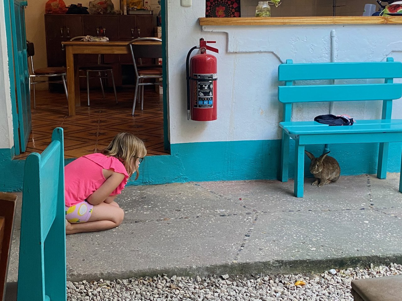
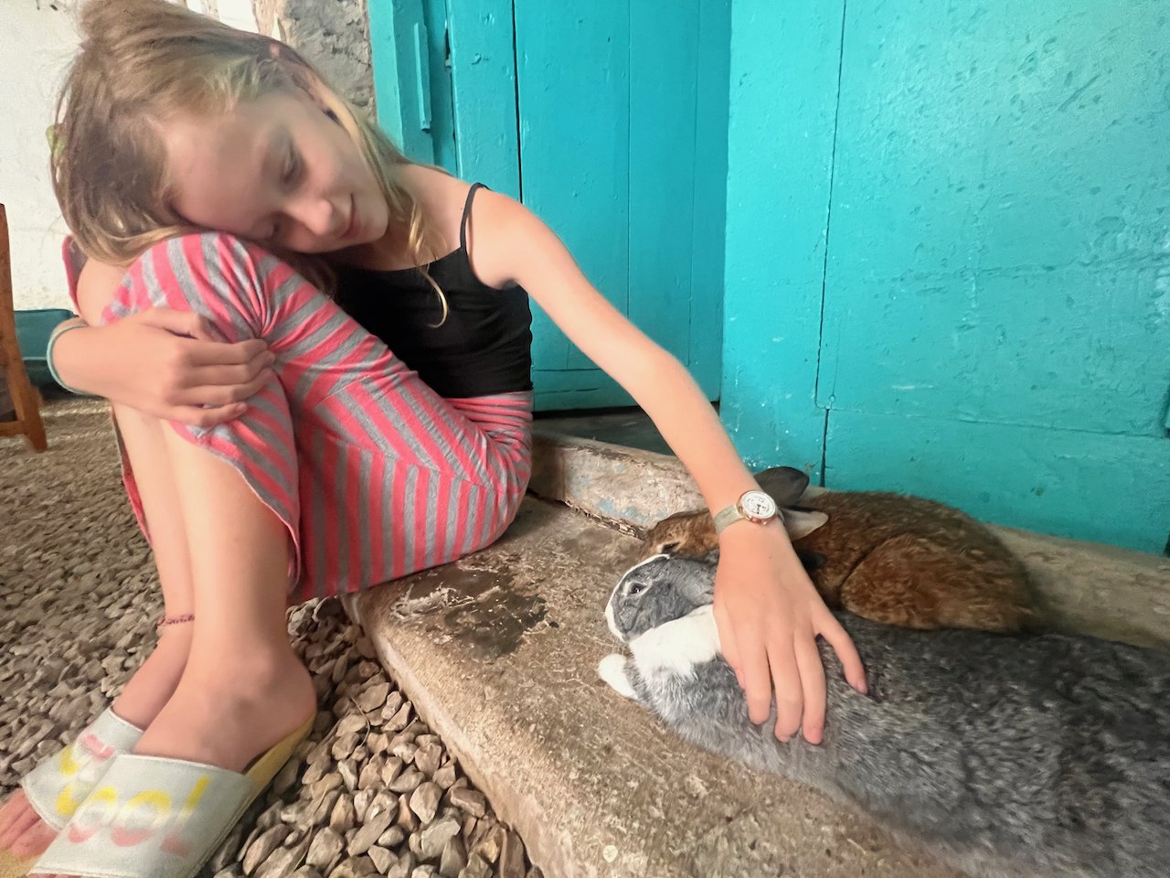
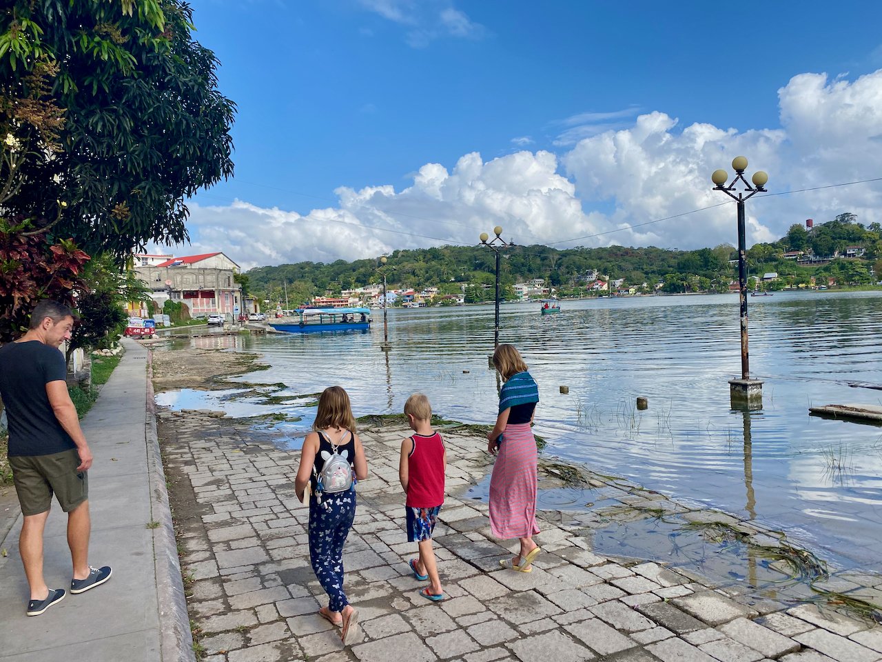
The town of Flores is on an island on Lake Petén Itzá. We booked a few nights at Los Amigos, a hip and vibrant hostel that offered private family rooms. The roads on the island were very tiny and tight. We luckily found a spot to park Chuck but we didn’t move him once. The hostel had everything we needed; places to work, spots to read, bunny rabbits, and good food. Yep, bunny rabbits. We used our few days to catch up on schoolwork, do some administration, find the next few places to stay, and explore the cute, backpacker town.


Our next destination was Semuc Champey, a natural wonder deep in the jungle. We knew that the drive would be a long one, but the staff at the hostel said we’d be best to drive the route in one day rather than try to find a hotel somewhere along the route. Unfortunately, we didn’t confirm which route to take and we decided to follow the Google Maps suggested route. That decision was both the best and worst one to date.

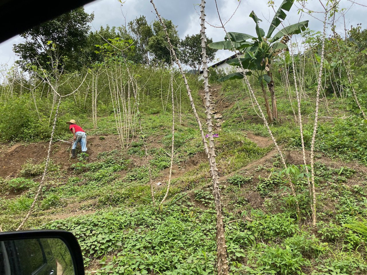
The total distance was 300km. Google said it would take nearly 7 hours. “That must be a mistake”, we said. An hour into the drive, we noticed the app telling us to “take the ferry”. Uh oh. What ferry? Turns out, there’s a small river that cuts the town of Sayaxchá. We stopped at the end of the road, were waved onto the next boat (fishing boat) leaving the shoreline, paid $3 while transiting, and backed off on the opposite shore. All in, it took 10 min. Sweet. But the maps app still said it would take 5 hrs to drive 200km. The roads continued to be excellent. We stayed on Highway 5, as the app said, until 40 km from our destination. With just 40 km left, the app said we needed 4 hrs to complete it. Well, the road turned from paved to gravel, but not the small gravel we know and love in Canada; it was a large, chunky, washed-out and rutted gravel road that was single lane in width, and narrowly large enough to cross paths with the motorbikes and pick-up trucks that were using the “highway” to get from town to town. The road wound up, down, between, and up a couple of lush green mountains that were spotted with farm fields. We needed our 4WD and a lot of faith to get through the tiny towns along the way. This road was epic. We got to see a part of Guatemala that I’m sure many others have never seen. We passed a number of small villages with men working their mountain-side farm plots, chickens and pigs running free, and the women cooking or washing clothes or carrying loads on their heads with babies on their backs and toddlers at their sides. I couldn’t believe how steep the farm plots were in many cases with corn growing in rows along land sloping at nearly 45 degrees. The whole scene was crazy scary (the driving at least) and insanely beautiful.


Google had been correct all along. It did take us nearly 4 hours to drive the final 40km. Sadly, since I spent much of the drive tightly gripping the car for safety, I did not take many photos. I wish that I had. The remoteness and beauty were surreal and hard to describe with words.
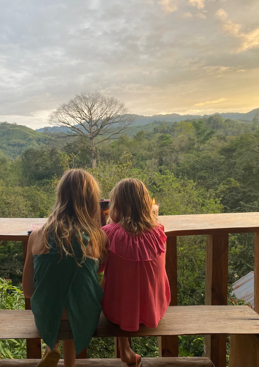
We arrived at our destination, Utopia Eco Hotel, by 5 pm feeling happy to be done driving and relieved that we’d survived. The owner greeted us with a warm welcome (and a cold, nerve-calming drink) and made sure we were able to relax before dinner. The hotel is an impressive place with cabins and a large common area. They serve vegetarian meals, awesome drinks, and offer free morning yoga with an amazing jungle view. They also offer local tours to Semuc Chempey, a chocolate tour, and a tubing tour down the river. The whole place has such a calming and peaceful atmosphere that we let go of the harrowing journey immediately. The food was incredible and served by candle-light. Oh, and they had lots of friendly dogs that Molly made sure received lots of love. We slept like babies!


Semuc Champey is considered a natural monument. It’s a large limestone bridge that also contains cascading pools of water along the top of the bridge. These pools are warm, clear, and awesome to swim in. Under the bridge runs the fast Cahabón River. There’s a small entry fee to enter the park and a few hikes you can do. We chose to just swim and relax in the pools. It was magical.
Later that afternoon, we took a ride back towards the monument but got off at the river’s edge. With two young guides, we floated down the river, through 6 rapids, to reach to edge of Utopia’s property. The kids were chained together using their feet (tucked into the armpits of the person ahead of them). Erik and I were rafted to another guide. Both guides managed to steer us safely through the rapids and down to the hotel by using their flipflops at paddles. Oh, and they also both kept an open can of beer perched safely on their laps. It was impressive. Erik and I did have one mishap – we ended up flipping in the strongest rapids but were able to get back into our tubes and back into a line before the next rapids arrived. The water was pretty cold! The kids were all smiles and giggles so it was worth it!


After only two nights, we packed up and drove 30 min of tough, rough road before finding ourselves back on smooth, two-lane highway. We spent one night near the Biotopo del Quetzal, a cloud forest reserve and home to the famous quetzal bird, and marvelled at how cold it suddenly became. After a week in 30+ degree, humid weather, we were now in the cloud forest and needed to start a fire to stay warm through the night. Our hotel was very nice and had a yummy restaurant, a playground, a pond with fish, and a short but interesting nature hike. It was a great spot to help break up the long drive south.


Although the driving had been stressful, we were really glad that we decided to see Northern Guatemala. It’s gorgeous and wild, and forever in our memories.